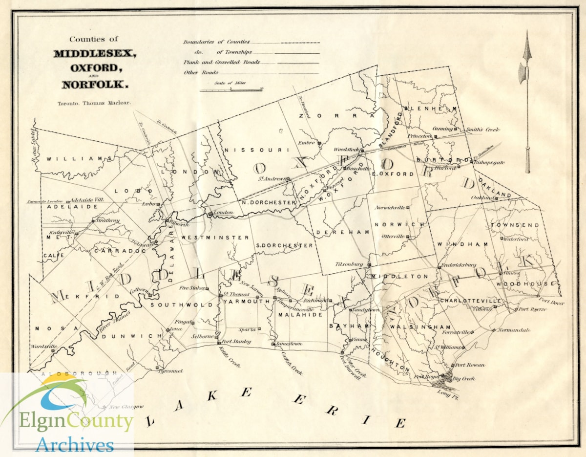
"Counties of Middlesex, Oxford, and Norfolk"
https://heritagecollections.elgin.ca/link/archives2909
- Museum / Archive
- Elgin County Archives
- Part Of
- Elgin County Map Collection
- Description Level
- Item
- GMD
- cartographic material
- Date Range
- ca. 1850-1855
- Accession Number
- 2004-26
- Storage Location
- M10j
- Museum / Archive
- Elgin County Archives
- Part Of
- Elgin County Map Collection
- Description Level
- Item
- Item Number
- MAP 186
- Accession Number
- 2004-26
- Storage Room
- Archives Storage Rm. 105
- Storage Location
- M10j
- GMD
- cartographic material
- Date Range
- ca. 1850-1855
- Publication
- Posted on Facebook, Twitter and Instagram: August 21, 2020.
- Physical Description
- 1 map; 24 x 33 cm
- Material Details
- (To zoom in closer on the map, click on the PDF file)
- Scope and Content
- Map depicting townships in Middlesex, Oxford, and Norfolk Counties, including townships that formed Elgin County in 1852. Several of the villages noted on the map have since disappeared or changed names. These include: Selborne, Five Stakes (now Talbotville), Temperanceville, Jamestown, Sandytown (now Straffordville). Map also depicts early roads and the route of the Great Western Rail Road through Oxford and Middlesex Counties.
- Subject Access
- Maps, Early
Documents
Images
{{ server.message }}
{{ server.message }}