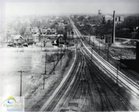
Aerial Photograph - Pere Marquette Railway tracks through St. Thomas, Ontario
https://heritagecollections.elgin.ca/link/archives161282
- Museum / Archive
- Elgin County Archives
- Part Of
- Ken Verrell Collection
- Description Level
- Item
- GMD
- graphic material
- Date Range
- ca. 1940s
- Accession Number
- 2016-30
- Storage Location
- R4 S5 Sh3 B7 F10 2
- Museum / Archive
- Elgin County Archives
- Part Of
- Ken Verrell Collection
- Description Level
- Item
- File Number
- R4 S5 Sh3 B6 F10
- Accession Number
- 2016-30
- Storage Room
- Archives Storage Rm. 107
- Storage Location
- R4 S5 Sh3 B7 F10 2
- GMD
- graphic material
- Date Range
- ca. 1940s
- Physical Description
- 1 photograph : b&w ; 20.5 x 25.5 cm
- Scope and Content
- Aerial view of St. Thomas, Ontario featuring the Pere Marquette Railway (later Chesapeake and Ohio Railway) tracks. View is looking north with Alma College and the Moore Street Water Tower visible in the distance.
- Name Access
- Pere Marquette Railway
- St. Thomas (Ont.)
- Subject Access
- Aerial Photographs
Images
{{ server.message }}
{{ server.message }}
