
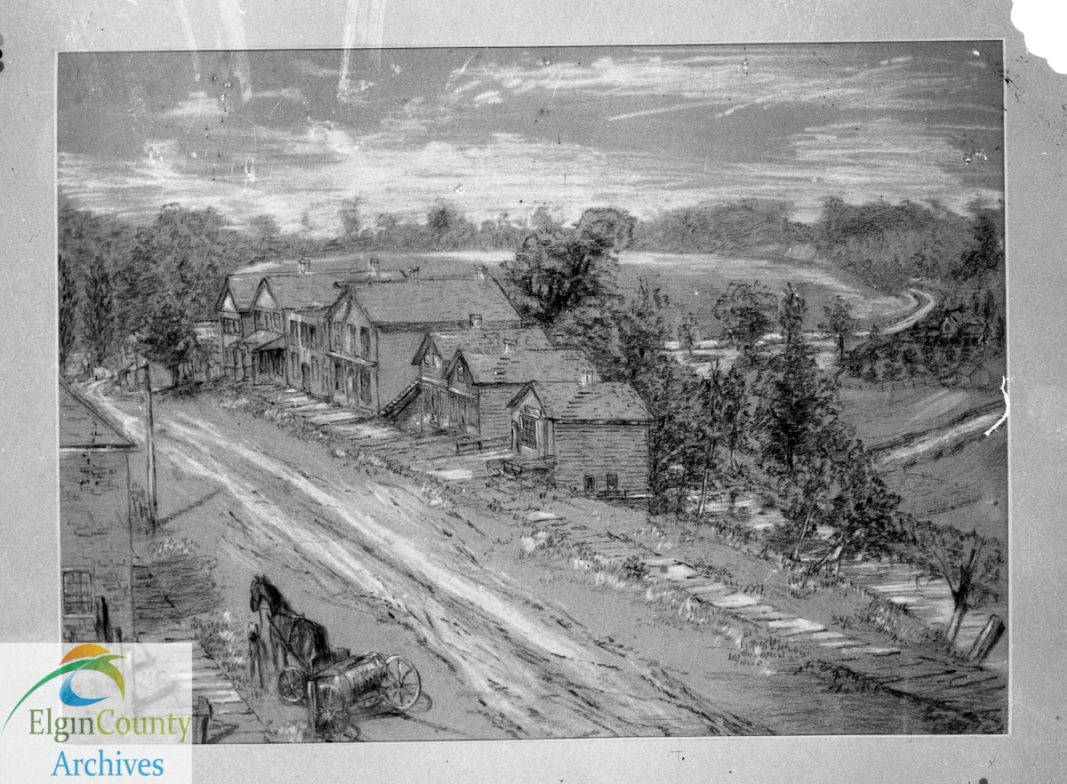
Talbot Street, St. Thomas, looking west from King Street toward Pleasant Street
https://heritagecollections.elgin.ca/link/archives114403
- Museum / Archive
- Elgin County Archives
- Part Of
- Ian D. Cameron Collection
- Description Level
- File
- GMD
- graphic material
- Date Range
- ca. 1857
- Accession Number
- 2011-10
- Storage Location
- R11 S5 Sh1 B1 F42
- Museum / Archive
- Elgin County Archives
- Part Of
- Ian D. Cameron Collection
- Description Level
- File
- Item Number
- B-1
- Accession Number
- 2011-10
- Storage Room
- Archives Storage Rm. 110
- Storage Location
- R11 S5 Sh1 B1 F42
- GMD
- graphic material
- Date Range
- ca. 1857
- Publication
- Posted on Facebook: May 16, 2019.
- Scope and Content
- Chalk drawing, ca. 1857, showing Talbot Street, St. Thomas, looking west from King Street toward Pleasant Street. View includes original businesses on the north side of the street (current site of the Jumbo Monument), which were likely removed when the street was widened in 1930; and roadway then known as the road to Garret Smith's farm (follows the current route of Crescent Avenue, St. Thomas). Original drawing in Elgin County Museum collection. File includes:
- plastic negative
- glass lantern slide
- Down the Street to Yesterday Zone 2 (Pleasant to King)
- Website / Street View Notes
- For contemporary view see Google Street View accessed August 13, 2014.
Websites
Images
{{ server.message }}
{{ server.message }}